|
|
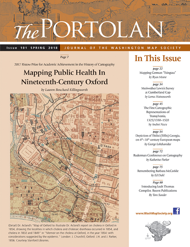
The Portolan Issue #101 - Spring 2018 ARTICLES Mapping Public Health In Nineteenth-Century Oxford by Lauren Bouchard Killingsworth WINNER RISTOW PRIZE 2017 Mapping German “Tsingtau” by Ryan Moore Meriwether Lewis’s Survey at Cumberland Gap by Lorna Hainesworth. The first cartographic representations of Transylvania, 1325/1330 – 1520 by Andrei Nacu Depiction of Tbilisi (Tiflis), Georgia, on 4th - 18th century European maps by Dr. George Lobzhanidze RECENT PUBLICATIONS This regular feature, a bibliographic listing of articles and books appearing worldwide on antique maps and globes and the history of cartography, is compiled by Leah M. Thomas. BOOK REVIEWS -Cyprus: The Book of Maps. Annotated Catalogue of the Printed Maps of Cyprus, Volume 1: 15th-16th Centuries (Reviewer Bert Johnson) -An Architect Paints (Reviewer: Leah Thomas) -Mapping the Philippine Seas (Reviewer: Hal Meinheit) -Remapping Modern Germany after National Socialism, 1945-1961 (Reviewer: Ryan Moore) -Exploring Africa with Ancient Maps (Reviewer: Jocelyn Coulon) -Oxford Atlas of the World, 24th Edition (Reviewer: John Rennie Short) SHORTER ITEMS 1. President’s Spring 2018 Letter 2. Washington Map Society Meetings: March – May 2018 3. Exhibitions and Meetings 4. Ristow Prize Competition 2018 5. Barry Lawrence Ruderman Conference on Cartography, Oct 19-21, 2017, by Katherine Parker 6. Spotlight on the WMS Membership – Mason Goldman, Pierre Joppen, Jonathan Levin 7. Remembering Barbara McCorkle, by Ed Dahl 8. Letters to The Editor 9. Cartographic Notes, by Thomas Sander 10. Introducing Leah Thomas, Compiler, Recent Publications, eff Spring 2018, by Thomas Sander |
© 2021 Washington Map Society. All Rights Reserved. |
|