|
|
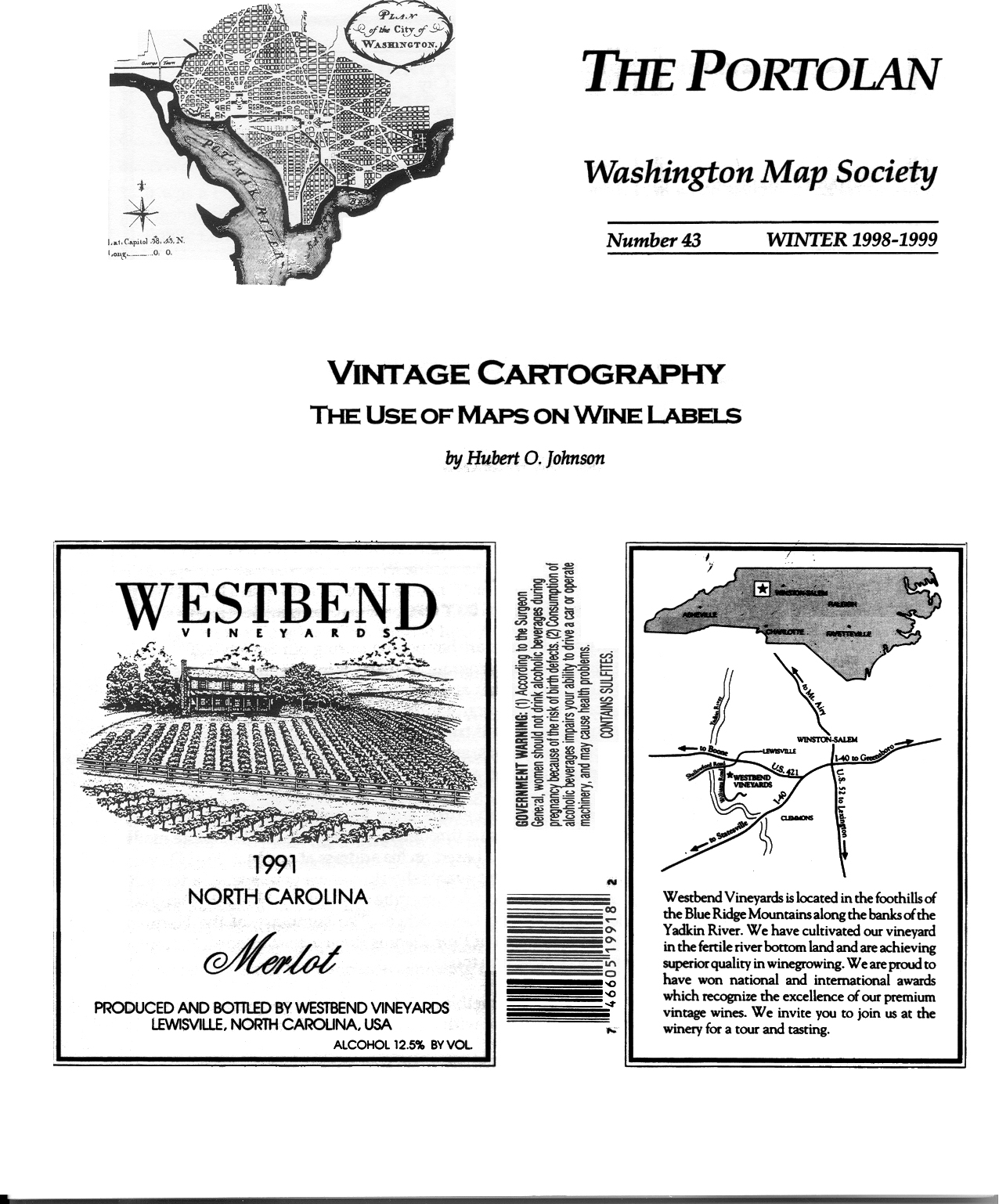
The Portolan Issue #43 - Winter 1998-1999 ARTICLES Vintage Cartography - The Use of Maps on Wine Labels. by Hubert O. Johnson. Early Maps of Africa: The Crucial Decades from 1490 to 1520. A summary by Steven J. Vogel of a presentation to the Society by Fred L. Hadsel. The World of Herman Moll. A summary by Steven J. Vogel of a presentation to the Society by Dennis Reinhartz. Henry Hudson, Hessell Gerritsz and Habbakkuk Prickett. by Douglas McNaughton. Modern-Day Historical Mapping of Rural Virginia and Maryland. by Eugene M. Scheel. A Re-discovered Plan Map of Henrico Virginia, 1613. by Douglas McNaughton. RECENT PUBLICATIONS A regular feature in The Portolan, this is a bibliographic listing of articles and books appearing worldwide on antique maps and globes and the history of cartography. By Eric W. Wolf. BOOK REVIEW Pirî Reis and His Charts. (Review by Eric W. Wolf) SHORTER ITEMS 1. Washington Map Society Meetings, January – May 1999. 2. Exhibitions and Meetings, Until the Year 2000. 3. 1998 Ristow Prize Winners Announced. 4. Virginia in Maps (coming events at the Library of VA, April 1999). 5. Map Site Seeing, key World Wide Web map sites. 6. Washington Map Society November 1998 Field Trip to New York City. 7. Ralph Ehrenberg Retires. 8. Notes from, and Travels with, the Editor. |
© 2021 Washington Map Society. All Rights Reserved. |
|